 by
by he This article throws more light on what DJI Geofencing is and how you can work around it to give you great impact with your drone flights. Here you can also get the details on how to adhere to DJI geofence for your drone flight goals and the necessary steps to take for unlocking DJI Geofencing.
It is important to know that DJI will lock you out of flying in certain restricted areas without going through the necessary authorization or approval processes. It is also important for drone pilots to understand how to use the DJI geofence system and ways to unlock it. These and many more will be covered in this article.
Table of Contents
Airspace Authorization and DJI Geofence Zones
Now you have your Airspace Authorization license and you set out on the mission to fly your drone. Your drone then takes off and upon its starting point, it suddenly suspends in the middle of the air and starts hovering right there. Or when you try to set up to turn on your drone, the app suddenly will pop up a message indicating that you “can’t take off DJI no-fly zone.”
Getting to this point will let you know that as a pilot, you need to get permission to fly in such a zone.
This is not the case with DJI geofencing system which is quite different airspace restrictions that should be checked before embarking on a flight mission within controlled airspace.
DJI geofence system is restricted to some zones that prevent your DJI drone to fly in such areas. The purpose of this is to keep unauthorized drone pilots from flying their drones in restricted airspace as a measure for safety against security risks that can cause chaos triggering alarms at airports, and other restricted areas.
DJI geofence makes use of GPS and navigational satellite signals that can automatically prevent drones to fly near sensitive zones like airports, nuclear power plants, and prisons.
Special authorization needs to be granted to drone pilots with verified DJI accounts to unlock some areas where they can fly a DJI drone in a geofenced area.
So the categories of drones that you can need to take action to unlock include the authorization zones and restricted zones.
DJI Geofence Authorization and Restricted Zones
Authorization Zones
The authorization zone on the DJI geofencing map is shaded in blue color. By default, a flight within this region will not take off without first unlocking the zone which can be done by inputting your flight controller serial number on the DJI website.
Restricted Zones
The restricted zone is shaded in red color and the area is situated around the landing and departure ends of airport runways. These zones are also located around high-profiled buildings such as nuclear power plants, prisons, and government buildings.
Unlocking the restricted zones would require you to submit documentation from the controlling agency to DJI.
Authorization and Restricted Zones Image Illustration
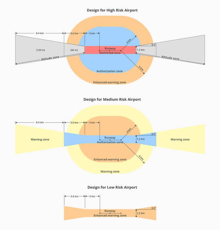
Image Source: DJI
Geofencing Background
Geofencing began with a restrictive basic two-dimensional circle placed around some regions within airports to prevent flights from taking off.
GEO 2.0 was introduced in 2018 following the drone incidents and lobbying by pilots to allow flight take-off in the previously no-fly zone.
In line with this, DJI took a major lead in collaborating work with multiple professional flying organizations on ways to proffer possible solutions for the two involved factors such as the pilots and public safety.
As a measure to improve the two-dimensional model of the enhanced geofencing version, a vertical element was also added which is ideal for standard airport safety zones.
How DJI geofence works
There is a huge three-dimensional area of geofencing database available all over Europe and the United States restricting flights in several ways and the locations include government buildings, prisons, airports, nuclear power plants, and other security vulnerable areas.
DJI geofence zones as shown in the image above are divided into Altitude zones, Authorization zones, and Restricted zones with different rules available for the different zone.
Types of geofencing
DJI geofence system is divided into three parts which include Low Risk, Medium Risk, and High Risk. Each part depends solely on air traffic volume and the in and out of numbers of passengers of a particular airport.
However, there are more restrictions for high-risk airports than low-risk. The illustration in the above image depicts how different zones between airports differ.
Example geofencing
Before a flight takes off, always check for DJI geofence restrictions even when you are not near a restricted zone. This is necessary as a temporary flight restriction might have popped up without you knowing.
You can check the most recent DJI geofence map restrictions for different zones with this link: www.dji.com/flysafe/geo-map.
The DJI geofence can also be checked through the DJI GO 4 app. On the start-up screen, simply tap on the main menu and then select “GEO Zones.”
Unlocking DJI Geofence
Now that you have checked up the DJI geofence restricted zones and found out that you want to fly in one of them, the next thing to do is how to unlock the DJI geofence. Well, this simply depends on where you intend to fly and who you are.
There are a few ways to unlock the boundaries of a Dji geofence:
- Open the Geofencing app and tap the “Unlock Geofence” button.
- Tap the geofence in the Maps app and then tap the “Unlock Geofence” button.
- Tap the geofence in the Photos app and then tap the “Unlock Geofence” button.
Self Unlocking
The DJI geofence self-unlock is for those who have good reason to fly in a blue-depicted, Authorization Zone. This requires you to have a separate ATC clearance to run your operation.
Verify your account
To verify your identity, DJI will need you verify your account using either your credit/debit card or your phone number. Bear in mind that DJI won’t store any of this information. They are simply needed just to verify your identity.
Real-time Unlocking with the DJI GO 4 App
As previously mentioned, you can alternatively unlock the DJI geofence through the DJI GO 4 App. This can be done the moment your drone is connected with an attempt to fly in an Authorization Zone.
The real-time Self-Unlocking is usually live because it is instantaneous. Though, this method requires the internet for the connection to take place.
Unlocking ahead of time
Another benefit of using DJI Geofence is that you can unlock the boundaries of the DJI geofence ahead of time. This gives you more flexibility in when and where you want to fly.
Besides, you can schedule more than 20 authorizations simultaneously on the internet. This is important in case you experience technical glitches or issues with internet connections within the area of your flight. The schedule can even last for up to three days after it is started.
To schedule the Dji geofence unlocking, go to the DJI self-unlocking page. You will also need to download your license to the app before going off the grid. To find the license, go to General Settings, and then go to Unlocking List.
Custom Unlocking
The custom unlocking is for users who are first responders or power plant inspectors. These set of user have the authorization to fly in the restricted zone such as power plants and airports.
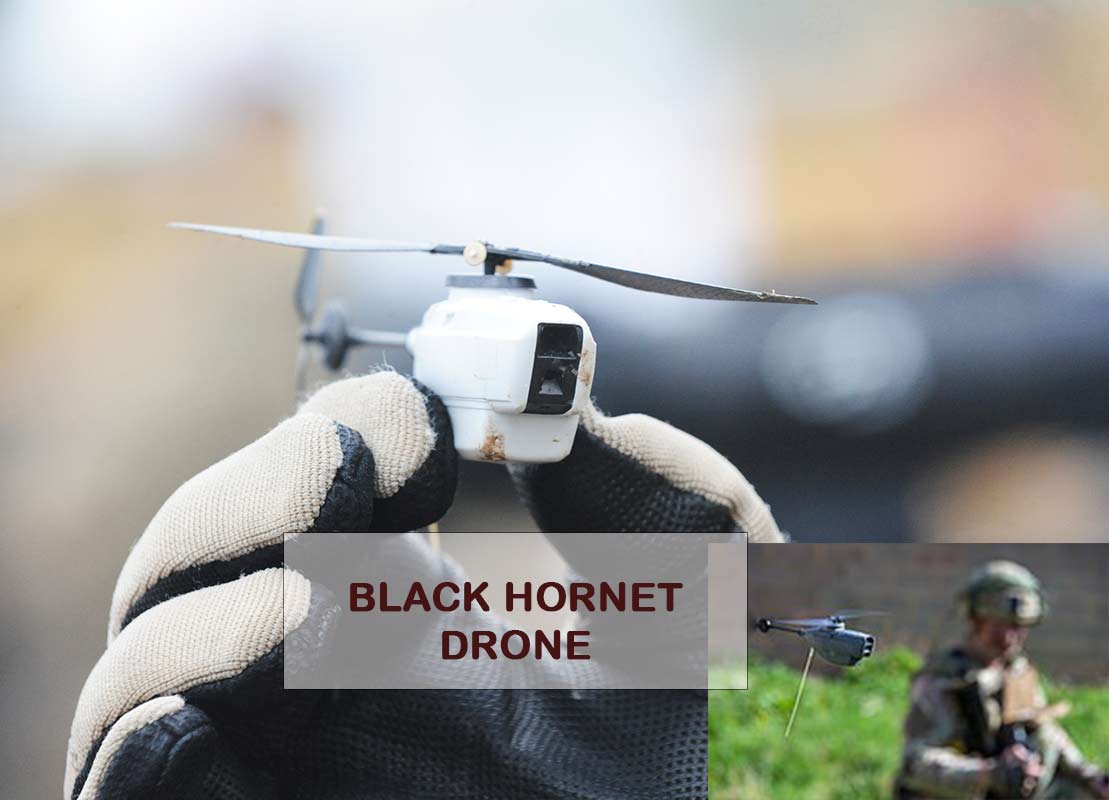
ALSO READ: Black Hornet Nano Unmanned Air Vehicle (UAV) Drone
DJI Geofence Frequently Asked Questions
What is DJI geofencing?
DJI geofencing makes use of GPS and some navigational satellite-based signals that automatically prevent drones from taking off their flight mode or flying close to sensitive zones such as airports, government buildings, nuclear power plants, prisons, and other high-profile locations without special authorization.
How do I unlock my DJI geofencing?
You can unlock your DJI geofencing using either your credit card or phone number associated with your DJI account. One of the two options will be required to verify your identify. And when using your phone number in the verification process, an authentication number will be sent to you via text. So ensure to have your phone handy.
When you eventually receive the authentication code, enter it in the provided box, and then click on “Confirm”. This will unlock the Self Unlock area that you want to fly.
Can you turn off DJI geofencing?
DJI Geofence restrictions are enabled by updating the device firmware. When the firmware is rolled back to its older version, the restrictions can be removed.
Drone owners can downgrade the firmware by using other available options of software like NLD on the internet.
Will DJI drone take off in restricted area?
DJI drone cannot take off in a restricted area and if it flies near the boundary of a restricted area, it will land automatically and starts hovering in place.
Do all drones have geofencing?
Some drones do not have geofencing features. But before getting one, make sure you are aware of the laws of your state concerning drone flight. Flying in restricted areas without authorization can be illegal and can come with a serious legal consequency.
How do drones find no fly zones?
Flight restrictions are specified to some particular zones. To find out no-fly zones, you can use the B4UFLY mobile app in locations you are planning to fly.
Can you fly a drone next to an airport?
You can fly a drone next to any airport except the ones that are in controlled-airspace that requires special authorization. Real-time access to controlled airspace near airports can be provided with special authorization.
Is there an app to detect a drone in the sky?
An app called Aerial Armor helps to detect a drone in the sky. This drone detection app is available on Android and Apple mobile devices.
You can leave a comment below to share your opinion about DJI geofence. Don’t forget to share this valuable information that can still be useful to other people.
Share